Nitinat Foil Donation
TunaCan - Wingfoiling |
Sunday June 04, 2023 1:09 PM |
| Spot | Nitinat Lk |
| Conditions | W 15-20, 1 |
| TOW | 3.0 hours |
| Toys | 95cm Mast Axis |
| 1210cm Foil Takuma | |
| 5 OR GLIDE | |
| 5'3 Takuma TK 80 | |
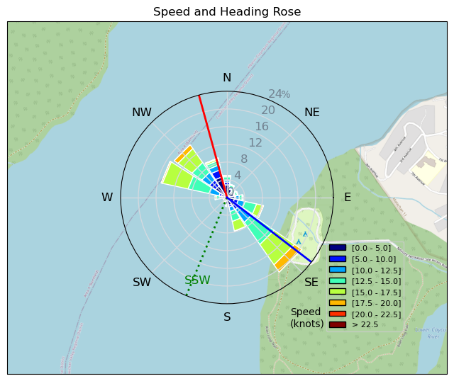
| Details | After foiling last night, I was having a beer with JJ on the beach when Bobson texted me saying Nitinat was great earlier that day. We decided right then to venture up there the next morning. Arrived at 11:45am to see Slogson turn into Bobson - stoked! Proceeded to be nicely powered on the 5m for a few hours. After coming down from a reasonable hoist near the end of my session I heard a funny crack below... popped back up and didnt think much of it till a few tacks later. Things started to feel a little funky so went into the beach. Noticed my fuse screws were a little loose. Tightened everything backup, and headed out, did another jump, landed fine, gybed, and CRACK whole setup gone. Fuse, front wing, and back wing. The Axis mast to Takuma fuse adaptor cracked in half sending my gear to the locker. C'est la vie. Hopefully my wife doesnt notice a new foil setup in the basement :) [from Sailing Log on Sunday June 04, 2023] |
Speed (3s average)
| Speed | knots | km/h |
|---|---|---|
| Avg overall | 6.5 | 12.0 |
| Avg in motion | 12.0 | 22.3 |
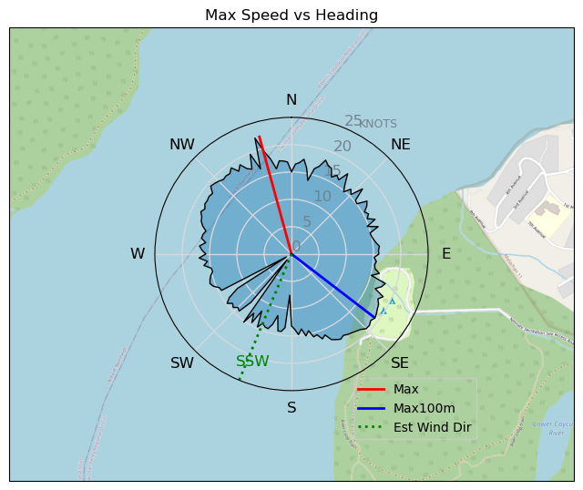
| Max | 22.2 | 41.2 |
| Max 100m | 19.0 | 35.2 |
| Max 250m | 18.5 | 34.2 |
| Max 500m | 18.3 | 33.8 |
| Max 2s | 22.0 | 40.8 |
| Max 10s | 19.0 | 35.2 |
| Max Alpha (500/50m) | 16.7 | 31.0 |
| Avg Foiling | 13.4 | 24.8 |
Times and Duration
| Start | Sun Jun 04, 1:09 PM |
| End | Sun Jun 04, 5:09 PM |
| Duration | 03:59:54 |
| In motion | 02:09:10 |
| Paused (< 3 km/h) | 01:49:07 |
| Foiling | 01:49:50 |
| Not Foiling (< 8 km/h) | 02:08:27 |
| Last Calculated | Sun Jun 04, 10:44 PM |
Track Information
| Distance | 47.9 km |
| # Trackpoints | 9061 |
| Avg Trackpoint distance | 5.3 m |
| Number of Turns | 179 |
| Foiling Turns (> 8 km/h) | 107 |
| Foiling Turn Percentage | 60% |


Category: Wingfoiling
2 years ago

Created 2 years ago
TunaCan |
Please register/login to download this track.
This track was downloaded 0 time(s). |
| 37 Rippin the right radii |
| 46 10/1/2025 Ross Bay |
| 52 2025NumeroUno |
| 45 Onwards to the 12th dimension |
| 44 RB omg best day of the year |
Please wait while loading suggestions..
Please wait while loading suggestions..
You must login to post comments.