He chose poorly
slake - Wingfoiling |
Sunday June 04, 2023 12:17 PM |
| Spot | Nitinat Lk |
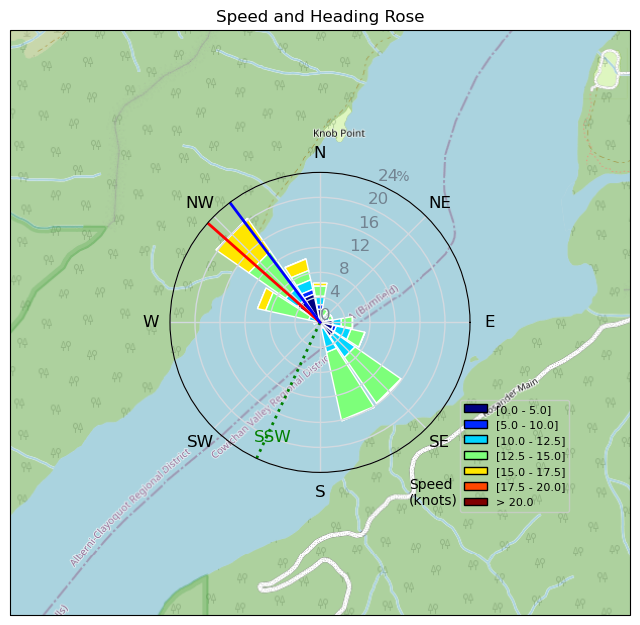
| Conditions | SW 10-20, Flat |
| TOW | 3.5 hours |
| Toys | Armstrong HA925 |
| 4m Duotone Slick | |
| 5'5" 88L Armstrong Wing SUP | |
| Details | Stubbornly took a 4 m and HA925 out hoping the wind would fill in. Would have been much better off with a bigger wing and/or foil. Floated around for almost an hour before even bothering to start my watch. Got going up the lake a bit and kept going as far as I could go. Then my progression to windward kept getting worse, wind lightening up, gybes happening on glassier and glassier water, until I came off foil. Slogged back downwind for ~20 min then popped up on foil and came back to the beach and it was already time to head home. Mad pumping sucks (especially after fatigue from the previous day). Thought of Indiana Jones and the Last Crusade when they're at the Holy Grail: "He chose poorly". Fun times to be back at Nitinat and see some familiar faces. [from Sailing Log on Sunday June 04, 2023] |
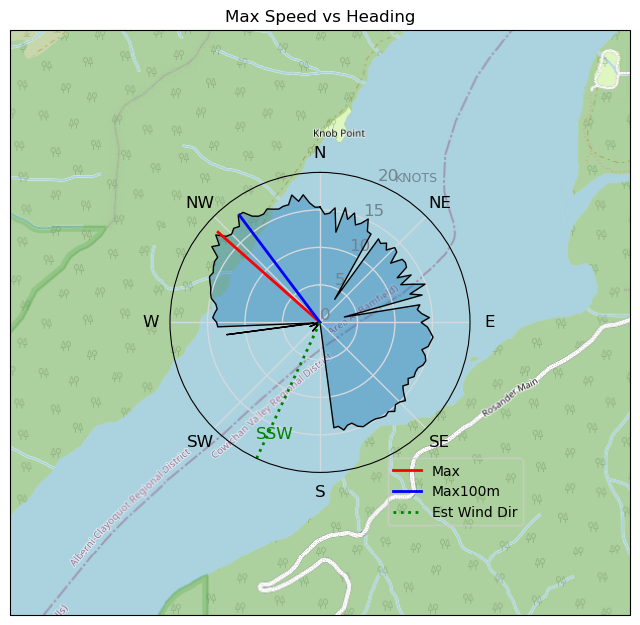
Speed (3s average)
| Speed | knots | km/h |
|---|---|---|
| Avg overall | 9.9 | 18.3 |
| Avg in motion | 10.2 | 18.8 |
| Max | 18.1 | 33.6 |
| Max 100m | 18.0 | 33.3 |
| Max 250m | 17.4 | 32.1 |
| Max 500m | 15.9 | 29.5 |
| Max 2s | 18.1 | 33.6 |
| Max 10s | 18.0 | 33.3 |
| Max Alpha (500/50m) | 14.4 | 26.7 |
| Avg Foiling | 13.1 | 24.2 |
Times and Duration
| Start | Sun Jun 04, 12:17 PM |
| End | Sun Jun 04, 2:56 PM |
| Duration | 02:38:47 |
| In motion | 02:34:49 |
| Paused (< 3 km/h) | 00:03:54 |
| Foiling | 01:50:21 |
| Not Foiling (< 8 km/h) | 00:48:22 |
| Last Calculated | Mon Jun 05, 7:04 AM |
Track Information
| Distance | 48.5 km |
| # Trackpoints | 3330 |
| Avg Trackpoint distance | 14.6 m |
| Number of Turns | 72 |
| Foiling Turns (> 8 km/h) | 53 |
| Foiling Turn Percentage | 74% |


Category: Wingfoiling
2 years ago

Created 2 years ago
slake |
Please register/login to download this track.
This track was downloaded 0 time(s). |
| 37 Rippin the right radii |
| 46 10/1/2025 Ross Bay |
| 52 2025NumeroUno |
| 45 Onwards to the 12th dimension |
| 44 RB omg best day of the year |
Please wait while loading suggestions..
Please wait while loading suggestions..
You must login to post comments.