231202 Ross Bay
Highrocker - Wingfoiling |
Saturday December 02, 2023 11:51 AM |
| Spot | Ross Bay |
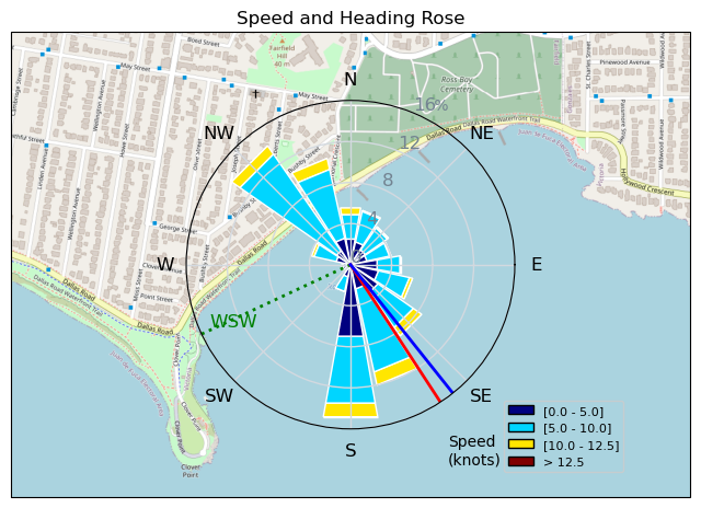
| Conditions | WSW 15-25, 1-3ft swell |
| TOW | 2.0 hours |
| Toys | 2050sqcm Axis 1020mm Carbon Front Wing |
| 750mm Axis Aluminum Mast | |
| 6m Cabrinha X3 Windows | |
| Details | Aaaaaah, so nice! Steady winds, consistently powered, and surrounded by talented wingers to try and emulate. Fantastic two session day. I stayed in the bay since there was lots of wind right in there. My 6m was occasionally OP'd, particularly the further outside I got. That was 4m territory. I had a gun in a knife fight. It felt harder to lift late in the second session and I called it a day. Just in time to watch the others slog/walk back. [from Session Log on Saturday December 02, 2023] |
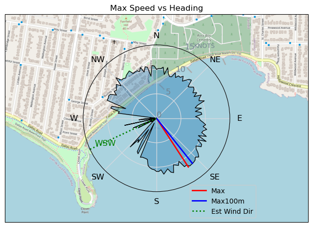
Speed (3s average)
| Speed | knots | km/h |
|---|---|---|
| Avg overall | 3.5 | 6.5 |
| Avg in motion | 7.4 | 13.7 |
| Max | 11.9 | 22.0 |
| Max 100m | 11.4 | 21.2 |
| Max 250m | 10.4 | 19.2 |
| Max 500m | 9.7 | 17.9 |
| Max 2s | 11.9 | 22.0 |
| Max 10s | 11.7 | 21.7 |
| Max Alpha (500/50m) | 9.6 | 17.8 |
| Avg Foiling | 8.3 | 15.4 |
Times and Duration
| Start | Sat Dec 02, 11:51 AM |
| End | Sat Dec 02, 2:07 PM |
| Duration | 02:16:12 |
| In motion | 01:05:09 |
| Paused (< 3 km/h) | 01:04:24 |
| Foiling | 00:52:22 |
| Not Foiling (< 8 km/h) | 01:17:11 |
| Longest Foiling Segment | 00:05:36 (1.5 km) |
| Last Calculated | Sat Dec 02, 5:59 PM |
Track Information
| Distance | 14.9 km |
| # Trackpoints | 1906 |
| Avg Trackpoint distance | 7.8 m |
| Number of Turns | 79 |
| Foiling Turns (> 8 km/h) | 56 |
| Foiling Turn Percentage | 71% |


Category: Wingfoiling
one year ago

Created one year ago
Highrocker |
Please register/login to download this track.
This track was downloaded 0 time(s). |
| 37 250112 Cattle Point |
| 34 Speedy (for me) wave riding |
| 38 CP - TunaCan Flyby |
| 60 Rippin the right radii |
| 64 10/1/2025 Ross Bay |
Please wait while loading suggestions..
Please wait while loading suggestions..
You must login to post comments.