Cool NE
sixlinewrasse - Wingfoiling |
Tuesday November 19, 2024 2:19 PM |
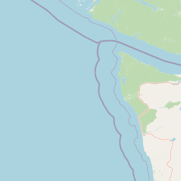
| Spot | [Secret spot] |
| Conditions | NE 19-25, flat to chop to swell |
| TOW | 1.5 hours |
| Toys | 5' 0" , 72 Lts KT Hawaii Quatro Drifter Pro |
| 4M Ocean Rodeo Glide A | |
| 1050MA cm2 foil North Sonar | |
| 85cm C Mast North Sonar | |
| 75 cm C Fuse North Sonar | |
| S215 Stab North Sonar | |
| Details | Cool North Easterly. Snow on the hills. No rain! Shared the session. Challenging to get started with eel grass in the first 200 yards. Warm in the medium tall Mystic 3/4 with a large Xcell 4/5 worn over top. 7mm mitts! 8mm boots! Impact vest with lower foam removed to suit waist harness. Gusty and some serious wind! Some nice downwind rides. [from Session Log on Tuesday November 19, 2024] |


Distance: 14.9 kmTime: 01:21:15Max Speed (3s avg): 14.1 ktsMax Speed (no avg): 20.7 ktsMax Acceleration: 0.5 m/s²
Speed (3s average)
| Speed | knots | km/h |
|---|---|---|
| Avg overall | 5.9 | 11.0 |
| Avg in motion | 8.9 | 16.5 |
| Max | 14.1 | 26.2 |
| Max 100m | 13.1 | 24.2 |
| Max 250m | 12.8 | 23.8 |
| Max 500m | 12.5 | 23.1 |
| Max 2s | 14.1 | 26.1 |
| Max 10s | 13.5 | 25.1 |
| Max Alpha (500/50m) | 10.8 | 20.0 |
| Avg Foiling | 10.1 | 18.6 |
Times and Duration
| Start | Tue Nov 19, 2:19 PM |
| End | Tue Nov 19, 3:40 PM |
| Duration | 01:21:15 |
| In motion | 00:54:00 |
| Paused (< 3 km/h) | 00:17:13 |
| Foiling | 00:43:06 |
| Not Foiling (< 8 km/h) | 00:28:07 |
| Longest Foiling Segment | 00:13:17 (4.1 km) |
| Last Calculated | Tue Nov 19, 5:17 PM |
Track Information
| Distance | 14.9 km |
| # Trackpoints | 4844 |
| Avg Trackpoint distance | 3.1 m |
| Number of Turns | 15 |
| Foiling Turns (> 8 km/h) | 8 |
| Foiling Turn Percentage | 53% |


Category: Wingfoiling
3 months ago

Created 3 months ago
sixlinewrasse |
Please register/login to download this track.
This track was downloaded 0 time(s). |
| 41 250202 Fleming Beach |
| 32 RB - Wishful |
| 19 250201 Ross Bay |
| 53 February wild start |
| 48 CP - Bad Call Bobson |
Please wait while loading suggestions..
Please wait while loading suggestions..

You must login to post comments.