Lunch Hour Work Out - first go on the HA1080
ThePope - Wingfoiling |
Tuesday December 10, 2024 11:38 AM |
| Spot | Cattle Pt |
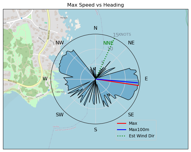
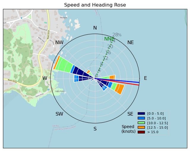
| Conditions | NNE 8-12, Flat |
| TOW | 1.0 hours |
| Toys | 70 Armstrong Fuse |
| 865 Armstrong Mast | |
| 220 Armstrong Glide | |
| 1080 Armstrong HA | |
| 7m Duotone Ventis | |
| 99L Armstrong FG Wing SUP | |
| Details | Lunch hour ultra light wind session with Bobson -- my first time launching from Cattle Point! I've been keen to test out a HA1080 front wing, so today seemed like the perfect light wind day to give it a try. Sweet Jesus it did not disappoint! It felt similar to the MA1475 in terms of lift, but it pumps up much easier. Similar to the HA880, it has such a nice and steady take off. The low end seems even lower than the MA1475, so I can't see how this doesn't become my new go-to light wind front wing. After an hour I was spent. Good exercise today! [from Session Log on Tuesday December 10, 2024] |
Speed (3s average)
| Speed | knots | km/h |
|---|---|---|
| Avg overall | 4.4 | 8.2 |
| Avg in motion | 5.7 | 10.6 |
| Max | 14.6 | 26.9 |
| Max 100m | 14.2 | 26.3 |
| Max 250m | 14.0 | 25.9 |
| Max 500m | 13.5 | 25.0 |
| Max 2s | 14.6 | 26.9 |
| Max 10s | 14.3 | 26.4 |
| Max Alpha (500/50m) | 10.4 | 19.2 |
| Avg Foiling | 10.2 | 19.0 |
Times and Duration
| Start | Tue Dec 10, 11:38 AM |
| End | Tue Dec 10, 12:43 PM |
| Duration | 01:05:23 |
| In motion | 00:50:27 |
| Paused (< 3 km/h) | 00:14:52 |
| Foiling | 00:18:58 |
| Not Foiling (< 8 km/h) | 00:46:21 |
| Longest Foiling Segment | 00:01:56 (715 m) |
| Last Calculated | Tue Dec 10, 2:29 PM |
Track Information
| Distance | 8.9 km |
| # Trackpoints | 2188 |
| Avg Trackpoint distance | 4.1 m |
| Number of Turns | 3 |
| Foiling Turns (> 8 km/h) | 1 |
| Foiling Turn Percentage | 33% |


Category: Wingfoiling
Yesterday

Created Yesterday
ThePope |
Please register/login to download this track.
This track was downloaded 0 time(s). |
| 36 CP - Sailing with The Pope |
| 40 Lunch Hour Work Out - first go on the HA1080 |
| 44 241208 Ross Bay |
| 48 RBombinoWesterly |
| 50 RB Dec 7 |
Please wait while loading suggestions..
Please wait while loading suggestions..
You must login to post comments.