Orca Swimpast for Greg
ThePope - Wingfoiling |
Saturday December 14, 2024 2:25 PM |
| Spot | Ross Bay |
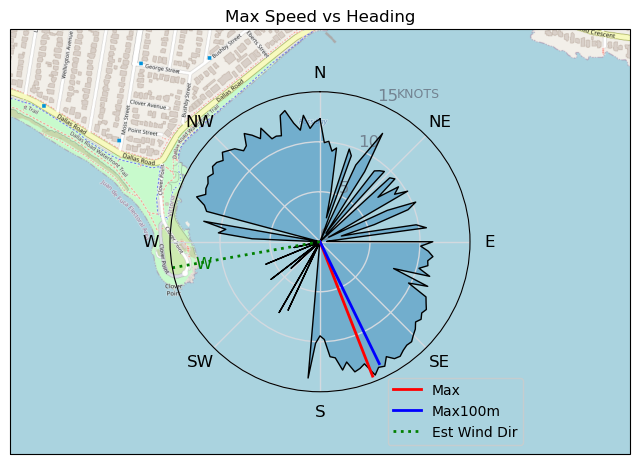
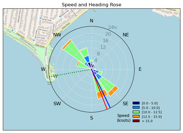
| Conditions | SW 25-32, 1.5m very confused |
| TOW | 0.8 hours |
| Toys | 99L Armstrong FG Wing SUP |
| 4m Duotone Unit | |
| 880 Armstrong HA | |
| 220 Armstrong Glide | |
| Popemobile | |
| 865 Armstrong Mast | |
| 70 Armstrong Fuse | |
| Details | Gnarly 45 min session (I had to hit the road by 330pm) where I was OP'd on my 4m the whole time, very confused seas, but nice to get out as always. Great to see so many people out for the Grew Caws gathering today. Thanks so much to Alain, Tweezer and Greg's family for organizing it! During the gathering a big transient male orca popped up just off Clover Point and then swam eastbound across Ross Bay, past all of us. I still can't believe this happened! A truly magical moment. [from Session Log on Saturday December 14, 2024] |
Speed (3s average)
| Speed | knots | km/h |
|---|---|---|
| Avg overall | 5.5 | 10.3 |
| Avg in motion | 9.3 | 17.3 |
| Max | 14.4 | 26.7 |
| Max 100m | 13.5 | 25.0 |
| Max 250m | 12.8 | 23.7 |
| Max 500m | 12.6 | 23.3 |
| Max 2s | 14.4 | 26.7 |
| Max 10s | 13.6 | 25.3 |
| Max Alpha (500/50m) | 10.2 | 18.9 |
| Avg Foiling | 10.4 | 19.3 |
Times and Duration
| Start | Sat Dec 14, 2:25 PM |
| End | Sat Dec 14, 3:11 PM |
| Duration | 00:46:07 |
| In motion | 00:27:23 |
| Paused (< 3 km/h) | 00:16:08 |
| Foiling | 00:21:12 |
| Not Foiling (< 8 km/h) | 00:22:19 |
| Longest Foiling Segment | 00:02:34 (842 m) |
| Last Calculated | Sat Dec 14, 10:01 PM |
Track Information
| Distance | 7.9 km |
| # Trackpoints | 1581 |
| Avg Trackpoint distance | 5.0 m |
| Number of Turns | 7 |
| Foiling Turns (> 8 km/h) | 1 |
| Foiling Turn Percentage | 14% |


Category: Wingfoiling
3 weeks ago

Created 3 weeks ago
ThePope |
Please register/login to download this track.
This track was downloaded 0 time(s). |
| 31 RB - 50km slide |
| 28 RB mini wave garden |
| 28 Gotta stop mowing the lawn |
| 19 RBKeepsOnGiving |
| 16 Magical RB Sunday session delivered. |
Please wait while loading suggestions..
Please wait while loading suggestions..
You must login to post comments.