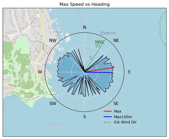
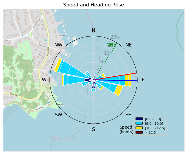
250103 Cattle Point
Highrocker - Wingfoiling |
Friday January 03, 2025 10:38 AM |
| Spot | Cattle Pt |
| Conditions | ENE 8-12, Mostly flat |
| TOW | 1.0 hours |
| Toys | 115L JP Australia Foil Pro |
| 6.2m Cabrinha Mantis | |
| 2050sqcm Axis 1020mm Carbon Front Wing | |
| 900mm Axis Aluminum Mast | |
| Details | Another fine lt wind session. I put in just after Bobson and GregCan had been out for a while. Kinda marginal as they were up and down. I got lucky with my big gear and got up on a gust just past the marker. Found a good pocket of wind between the yellow buoy and the marker. Nolan came out a bit later. I found lesss wind closer to JJI so I just played carving jibe games in the wind pocket. Jibes became a struggle so I ended it. Good cool, wet, fun! [from Session Log on Friday January 03, 2025] |
Speed (3s average)
| Speed | knots | km/h |
|---|---|---|
| Avg overall | 6.9 | 12.8 |
| Avg in motion | 7.5 | 13.8 |
| Max | 11.4 | 21.1 |
| Max 100m | 10.7 | 19.8 |
| Max 250m | 10.3 | 19.1 |
| Max 500m | 9.9 | 18.4 |
| Max 2s | 11.3 | 21.0 |
| Max 10s | 11.1 | 20.6 |
| Max Alpha (500/50m) | 9.9 | 18.4 |
| Avg Foiling | 8.4 | 15.6 |
Times and Duration
| Start | Fri Jan 03, 10:38 AM |
| End | Fri Jan 03, 11:45 AM |
| Duration | 01:07:35 |
| In motion | 01:02:18 |
| Paused (< 3 km/h) | 00:04:44 |
| Foiling | 00:50:54 |
| Not Foiling (< 8 km/h) | 00:16:08 |
| Longest Foiling Segment | 00:26:00 (7.0 km) |
| Last Calculated | Fri Jan 03, 2:52 PM |
Track Information
| Distance | 14.4 km |
| # Trackpoints | 1240 |
| Avg Trackpoint distance | 11.6 m |
| Number of Turns | 44 |
| Foiling Turns (> 8 km/h) | 41 |
| Foiling Turn Percentage | 93% |


Category: Wingfoiling
3 days ago

Created 3 days ago
Highrocker |
Please register/login to download this track.
This track was downloaded 0 time(s). |
| 53 4/1/2025 Pipers |
| 51 IV - Nailed an Hour |
| 47 Pt.Holmes 01/04/25 |
| 68 CP - Light Wind Hail sesson |
| 66 cattle point - super light wind for me. |
Please wait while loading suggestions..
Please wait while loading suggestions..
You must login to post comments.