Wisdom of the Tweezer
ThePope - Wingfoiling |
Tuesday January 07, 2025 4:03 PM |
| Spot | [Secret spot] |
| Conditions | SW 18-24, 1m |
| TOW | 2.0 hours |
| Toys | 70 Armstrong Fuse |
| 865 Armstrong Mast | |
| 220 Armstrong Glide | |
| 1080 Armstrong HA | |
| 5.5m Duotone Unit SLS | |
| 99L Armstrong FG Wing SUP | |
| Details | Step 3 for overcoming gybevoidance is to follow the wisdom of the elders -- in this case Tweezer! The trade winds were replaced by light Kona winds last week, and I remembered that the same happened to Tweezer last year. A few texts with the man himself, some studying up on his GPS tracks, gave me the confidence to navigate the long and winding narrow channel off the launch beach and out into the bay with multiple reefs and sandbars. I had to make a whole lot of gybe attempts because of the relatively small area that had enough depth to foil in, and I was too scared to go beyond the reef. Thanks Tweeze!!! [from Session Log on Tuesday January 07, 2025] |
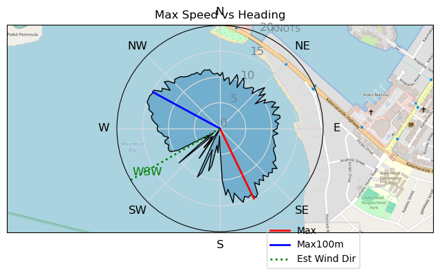
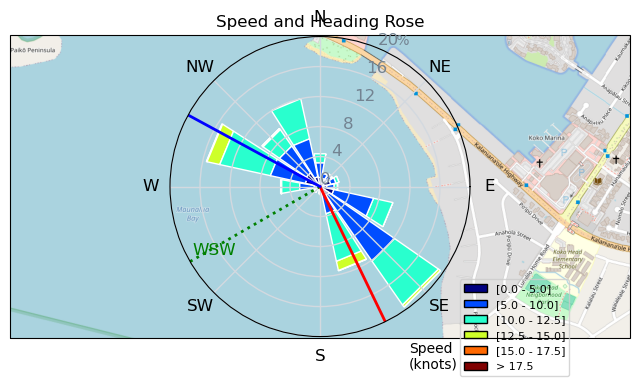
Speed (3s average)
| Speed | knots | km/h |
|---|---|---|
| Avg overall | 5.5 | 10.1 |
| Avg in motion | 8.7 | 16.1 |
| Max | 15.1 | 27.9 |
| Max 100m | 14.8 | 27.4 |
| Max 250m | 13.8 | 25.6 |
| Max 500m | 11.8 | 21.8 |
| Max 2s | 15.1 | 27.9 |
| Max 10s | 14.8 | 27.4 |
| Max Alpha (500/50m) | 10.5 | 19.5 |
| Avg Foiling | 9.6 | 17.8 |
Times and Duration
| Start | Tue Jan 07, 4:03 PM |
| End | Tue Jan 07, 6:16 PM |
| Duration | 02:12:39 |
| In motion | 01:23:26 |
| Paused (< 3 km/h) | 00:49:09 |
| Foiling | 01:08:19 |
| Not Foiling (< 8 km/h) | 01:04:16 |
| Longest Foiling Segment | 00:03:06 (982 m) |
| Last Calculated | Tue Jan 07, 7:42 PM |
Track Information
| Distance | 22.4 km |
| # Trackpoints | 4669 |
| Avg Trackpoint distance | 4.8 m |
| Number of Turns | 45 |
| Foiling Turns (> 8 km/h) | 16 |
| Foiling Turn Percentage | 36% |


Category: Wingfoiling
Yesterday

Created Yesterday
ThePope |
Please register/login to download this track.
This track was downloaded 0 time(s). |
| 75 Wisdom of the Tweezer |
| 38 Pt.Holmes 01/07/25 |
| 79 4/1/2025 Pipers |
| 73 IV - Nailed an Hour |
| 62 Pt.Holmes 01/04/25 |
Please wait while loading suggestions..
Please wait while loading suggestions..
You must login to post comments.