LotsaFlotsam
UnusuallyLargeRobin - Wingfoiling |
Thursday January 04, 2024 2:34 PM |
| Spot | Ross Bay |
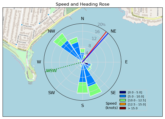
| Conditions | W 14-17, flattish |
| TOW | 0.8 hours |
| Toys | 187 lb / 85 kg Me Carbon-based Lifeform |
| Crazy Short (60.0cm) Axis Black Advanced Fuselage | |
| HPS 1050 (1460cm2) Axis Foil | |
| 90cm Axis Alu Mast | |
| 425 P Axis Rear Foil/Stab | |
| 5.5 Duotone Unit | |
| 75 lt Fanatic Sky Wing 5'0 | |
| Details | Looked great on the cam while i desperately tried to finish up things and get there! Got there, still looking good(?), rigged the 4m, by the time i was ready to launch decided to go with the 5.5m as it had dropped and flattened out significantly. Got some runs in the sun, some twig trip ups and kelp slow downs. A lot of sneaky vertical sticks bobbing around that you could barely see until too late. The early crew got the good stuff. [from Session Log on Thursday January 04, 2024] |
Speed (3s average)
| Speed | knots | km/h |
|---|---|---|
| Avg overall | 6.4 | 11.9 |
| Avg in motion | 9.7 | 17.9 |
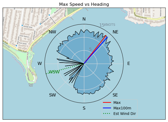
| Max | 13.6 | 25.1 |
| Max 100m | 12.2 | 22.6 |
| Max 250m | 11.3 | 20.8 |
| Max 500m | 11.0 | 20.4 |
| Max 2s | 13.5 | 25.1 |
| Max 10s | 13.0 | 24.0 |
| Max Alpha (500/50m) | 10.0 | 18.6 |
| Avg Foiling | 9.5 | 17.6 |
Times and Duration
| Start | Thu Jan 04, 2:34 PM |
| End | Thu Jan 04, 3:28 PM |
| Duration | 00:54:01 |
| In motion | 00:35:48 |
| Paused (< 3 km/h) | 00:18:10 |
| Foiling | 00:34:46 |
| Not Foiling (< 8 km/h) | 00:19:12 |
| Longest Foiling Segment | 00:16:26 (4.8 km) |
| Last Calculated | Fri Jan 05, 9:09 AM |
Track Information
| Distance | 10.7 km |
| # Trackpoints | 2249 |
| Avg Trackpoint distance | 4.7 m |
| Number of Turns | 38 |
| Foiling Turns (> 8 km/h) | 36 |
| Foiling Turn Percentage | 95% |


Category: Wingfoiling
one year ago

Created one year ago
UnusuallyLargeRobin |
Please register/login to download this track.
This track was downloaded 0 time(s). |
| 42 Falck’n Foot Switches |
| 49 250112 Cattle Point |
| 50 Speedy (for me) wave riding |
| 44 CP - TunaCan Flyby |
| 76 Rippin the right radii |
Please wait while loading suggestions..
Please wait while loading suggestions..
You must login to post comments.