wr980 downwinding
Tsawwassen - Wingfoiling |
Sunday April 07, 2024 12:04 PM |
| Spot | [Secret spot] |
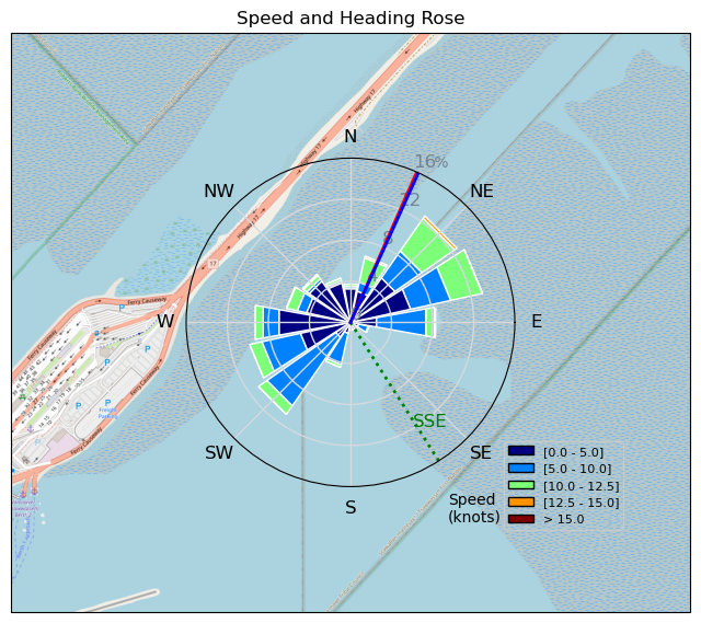
| Conditions | S 12-17, knee high |
| TOW | 2.0 hours |
| Toys | Sabfoil 370 Stab |
| 93cm Sabfoil Kraken Mast | |
| 653 mm Sabfoil Kraken Fuse F653K | |
| 938 cm sq Sabfoil WR980 | |
| 5.0 KT Wing Air | |
| 72 KT Wing Drifter | |
| Details | Fun session at the Terminal with Dmitry, Andrew and a few others. Finally had a good session on my wr980 and had a bit of a taste of what down winding would be like. There was some nice knee high swell at the end of the terminal where Dmitry and I sailed for a while. You could jibe off one and then just cruise toeside down wind for what seemed like ages. Then back out and repeat. So much fun for a light wind day but a downwind board would have made it even better. Forgot to turn my GPS on until about half way through me session. [from Session Log on Sunday April 07, 2024] |
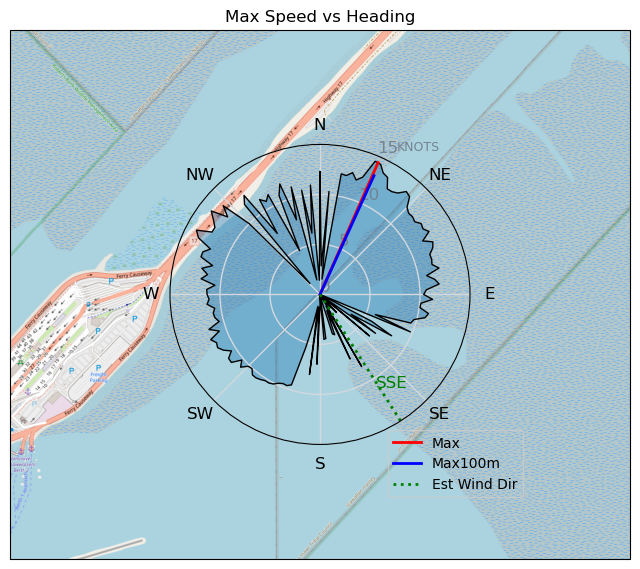
Speed (3s average)
| Speed | knots | km/h |
|---|---|---|
| Avg overall | 5.2 | 9.6 |
| Avg in motion | 7.5 | 13.8 |
| Max | 14.4 | 26.7 |
| Max 100m | 12.7 | 23.4 |
| Max 250m | 11.9 | 22.0 |
| Max 500m | 11.0 | 20.3 |
| Max 2s | 14.4 | 26.6 |
| Max 10s | 13.3 | 24.5 |
| Max Alpha (500/50m) | 7.2 | 13.3 |
| Avg Foiling | 9.1 | 16.9 |
Times and Duration
| Start | Sun Apr 07, 12:04 PM |
| End | Sun Apr 07, 1:12 PM |
| Duration | 01:08:46 |
| In motion | 00:47:41 |
| Paused (< 3 km/h) | 00:16:31 |
| Foiling | 00:33:29 |
| Not Foiling (< 8 km/h) | 00:30:43 |
| Longest Foiling Segment | 00:03:25 (957 m) |
| Last Calculated | Sun Apr 07, 8:28 PM |
Track Information
| Distance | 11.0 km |
| # Trackpoints | 3876 |
| Avg Trackpoint distance | 2.8 m |
| Number of Turns | 39 |
| Foiling Turns (> 8 km/h) | 4 |
| Foiling Turn Percentage | 10% |


Category: Wingfoiling
10 months ago

Created 10 months ago
Tsawwassen |
Please register/login to download this track.
This track was downloaded 0 time(s). |
| 63 Falck’n Foot Switches |
| 63 250112 Cattle Point |
| 64 Speedy (for me) wave riding |
| 58 CP - TunaCan Flyby |
| 87 Rippin the right radii |
Please wait while loading suggestions..
Please wait while loading suggestions..
You must login to post comments.