20240514
ThePope - Wingfoiling |
Tuesday May 14, 2024 6:13 PM |
| Spot | Ross Bay |
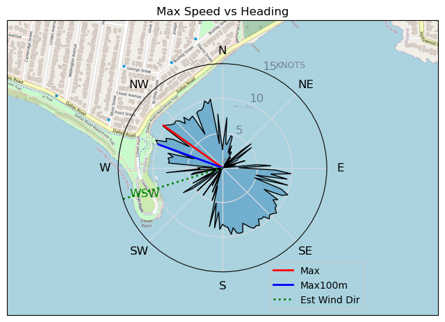
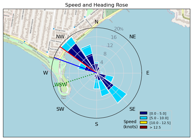
| Conditions | SW 14-18, 1m |
| TOW | 1.0 hours |
| Toys | 300V2 Armstrong CF |
| 865 Armstrong Mast | |
| 70 Armstrong Fuse | |
| 1850 Armstrong HS | |
| 7m Duotone Ventis | |
| 99L Armstrong FG Wing SUP | |
| Details | Arrived to Danno rigging up his 6 and what seemed like decent light winds. Danno launched but bobbed around and paddled back in. That prompted me to rig my 7 and I hastily launched while Danno, DrMark and Rob made the smart decision to wait on the beach for the wind to actually fill in. Fortunately I made it out to some breeze, which was also finally starting to build, and with the beastly 7 I managed to get on foil. For a few minutes I had the whole bay to myself, which was kind of cool but also made me a little nervous. Danno soon joined, as did Rob, DrMark, Tweezer, Ang and a few others. As the wind built I became more and more overpowered, but it was still good fun and I stayed on the inside of the bay quite a bit to practice toeside with marginal results. [from Session Log on Tuesday May 14, 2024] |
Speed (3s average)
| Speed | knots | km/h |
|---|---|---|
| Avg overall | 2.3 | 4.3 |
| Avg in motion | 5.0 | 9.3 |
| Max | 10.5 | 19.4 |
| Max 100m | 9.2 | 17.0 |
| Max 250m | 8.2 | 15.3 |
| Max 500m | 6.5 | 12.0 |
| Max 2s | 10.4 | 19.3 |
| Max 10s | 9.8 | 18.1 |
| Max Alpha (500/50m) | 6.4 | 11.8 |
| Avg Foiling | 6.2 | 11.5 |
Times and Duration
| Start | Tue May 14, 6:13 PM |
| End | Tue May 14, 7:19 PM |
| Duration | 01:05:57 |
| In motion | 00:30:36 |
| Paused (< 3 km/h) | 00:35:08 |
| Foiling | 00:12:31 |
| Not Foiling (< 8 km/h) | 00:53:13 |
| Longest Foiling Segment | 00:01:24 (321 m) |
| Last Calculated | Tue May 14, 10:14 PM |
Track Information
| Distance | 4.7 km |
| # Trackpoints | 1469 |
| Avg Trackpoint distance | 3.2 m |
| Number of Turns | 19 |
| Foiling Turns (> 8 km/h) | 0 |
| Foiling Turn Percentage | 0% |


Category: Wingfoiling
9 months ago

Created 9 months ago
ThePope |
Please register/login to download this track.
This track was downloaded 0 time(s). |
| 31 BWD got me addicted |
| 68 Falck’n Foot Switches |
| 65 250112 Cattle Point |
| 66 Speedy (for me) wave riding |
| 59 CP - TunaCan Flyby |
Please wait while loading suggestions..
Please wait while loading suggestions..
You must login to post comments.