SouthernComfort
UnusuallyLargeRobin - Wingfoiling |
Thursday May 23, 2024 4:46 PM |
| Spot | Ross Bay |
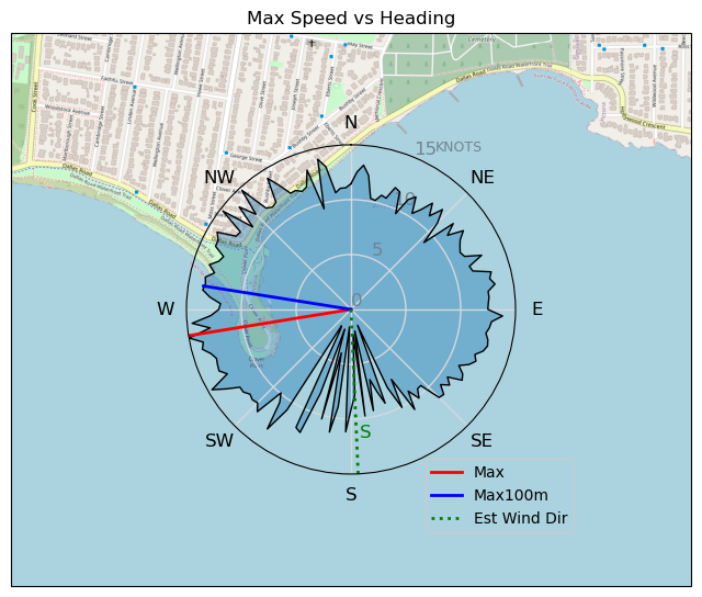
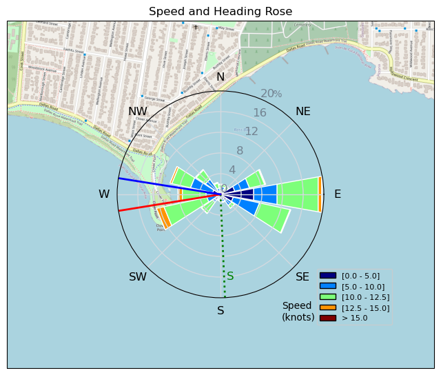
| Conditions | SSW 12-16, 1' |
| TOW | 1.0 hours |
| Toys | 187 lb / 85 kg Me Carbon-based Lifeform |
| 365/55 Skinny Axis Rear Foil/Stab | |
| Crazy Short (60.0cm) Axis Black Advanced Fuselage | |
| HPS 1050 (1460cm2) Axis Foil | |
| 90cm Axis Alu Mast | |
| 5.5 Duotone Unit | |
| 75 lt Fanatic Sky Wing 5'0 | |
| Details | Snagged a quick hour after work. Very south, so had to point towards the bottom of the bay and pump with selective puffs of wind to get flying before getting too far down into doldrum land. Once flying it was all good and you could head straight up the coastline on port tack. Very different wind angle than the normal westerly. [from Session Log on Thursday May 23, 2024] |
Speed (3s average)
| Speed | knots | km/h |
|---|---|---|
| Avg overall | 8.3 | 15.3 |
| Avg in motion | 9.4 | 17.3 |
| Max | 15.0 | 27.8 |
| Max 100m | 13.3 | 24.5 |
| Max 250m | 12.3 | 22.9 |
| Max 500m | 12.2 | 22.6 |
| Max 2s | 14.8 | 27.4 |
| Max 10s | 13.8 | 25.6 |
| Max Alpha (500/50m) | 10.7 | 19.9 |
| Avg Foiling | 10.2 | 18.9 |
Times and Duration
| Start | Thu May 23, 4:46 PM |
| End | Thu May 23, 5:37 PM |
| Duration | 00:50:18 |
| In motion | 00:44:33 |
| Paused (< 3 km/h) | 00:05:11 |
| Foiling | 00:38:43 |
| Not Foiling (< 8 km/h) | 00:11:01 |
| Longest Foiling Segment | 00:19:22 (6.3 km) |
| Last Calculated | Thu May 23, 7:55 PM |
Track Information
| Distance | 12.9 km |
| # Trackpoints | 3018 |
| Avg Trackpoint distance | 4.3 m |
| Number of Turns | 59 |
| Foiling Turns (> 8 km/h) | 48 |
| Foiling Turn Percentage | 81% |


Category: Wingfoiling
8 months ago

Created 8 months ago
UnusuallyLargeRobin |
Please register/login to download this track.
This track was downloaded 0 time(s). |
| 34 BWD got me addicted |
| 74 Falck’n Foot Switches |
| 67 250112 Cattle Point |
| 67 Speedy (for me) wave riding |
| 59 CP - TunaCan Flyby |
Please wait while loading suggestions..
Please wait while loading suggestions..
You must login to post comments.