Big XPS Fun
slake - Wingfoiling |
Friday August 30, 2024 12:57 PM |
| Spot | Nitinat Lk |
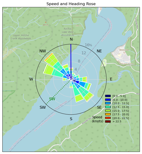
| Conditions | SW 8-16, 1' |
| TOW | 4.7 hours |
| Toys | Armstrong HA1125 |
| 6.1m Armstrong XPS | |
| 5'5" 88L Armstrong Wing SUP | |
| Details | Went out early to the far side as I saw some whitecaps. Took awhile to actually get going. Then went as far upwind as I could, much better with the bigger wing but eventually feels too light. Full day on the same gear. On water wing exchange with Tweezer in afternoon. Cabrinha handles very small diameter and easy on the hands. Got to see a real master moving the XPS around in all sorts of different transitions - very impressive. Saw 80 km on the watch, mowed the lawn for 20 km for triple digits, then end-of-day light wind transitions. Really helpful having the 6.1 XPS for light wind tacks, etc. [from Session Log on Friday August 30, 2024] |
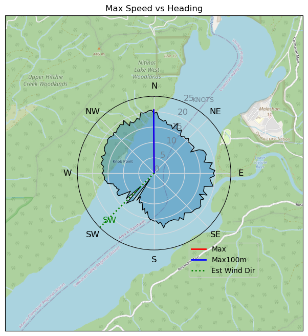
Speed (3s average)
| Speed | knots | km/h |
|---|---|---|
| Avg overall | 9.3 | 17.2 |
| Avg in motion | 12.8 | 23.7 |
| Max | 20.5 | 38.0 |
| Max 100m | 20.1 | 37.2 |
| Max 250m | 19.8 | 36.7 |
| Max 500m | 19.1 | 35.4 |
| Max 2s | 20.4 | 37.9 |
| Max 10s | 20.1 | 37.2 |
| Max Alpha (500/50m) | 16.7 | 30.9 |
| Avg Foiling | 13.6 | 25.1 |
Times and Duration
| Start | Fri Aug 30, 12:57 PM |
| End | Fri Aug 30, 7:01 PM |
| Duration | 06:04:07 |
| In motion | 04:24:29 |
| Paused (< 3 km/h) | 01:38:56 |
| Foiling | 04:04:07 |
| Not Foiling (< 8 km/h) | 01:59:18 |
| Longest Foiling Segment | 00:32:00 (13.8 km) |
| Last Calculated | Fri Aug 30, 8:52 PM |
Track Information
| Distance | 104.5 km |
| # Trackpoints | 7751 |
| Avg Trackpoint distance | 13.5 m |
| Number of Turns | 205 |
| Foiling Turns (> 8 km/h) | 169 |
| Foiling Turn Percentage | 82% |


Category: Wingfoiling
3 months ago

Created 3 months ago
slake |
Please register/login to download this track.
This track was downloaded 0 time(s). |
| 33 241124 Willows |
| 36 WillowsQuickie |
| 32 Willows - Sunday Funday Woops |
| 30 Willows Mixed Bag |
| 25 Surprise Sunday ENE. |
Please wait while loading suggestions..
Please wait while loading suggestions..
You must login to post comments.