240328 Cad Bay
Highrocker - Wingfoiling |
Thursday March 28, 2024 1:13 PM |
| Spot | [Secret spot] |
| Conditions | SE 20-30, 1-4ft swell |
| TOW | 0.5 hours |
| Toys | 900mm Axis Aluminum Mast |
| 2050sqcm Axis 1020mm Carbon Front Wing | |
| 4m Cabrinha X3 Windows | |
| 115L JP Australia Foil Pro | |
| Details | Not my finest session. I like the big winds, but getting through the shorebreak at Willows was an impossibility for me today. After 3 tries, with some coaching from WisePaul - I still managed to fail. Despite longing to play in the rough with Idefix, Greg, and Jon, I decide to not donate more cash to the Paul B repair fund. I had a look at Cad, and it was similarly tough. I was able to get a sheltered put-in at Loon Bay, just south of RVYC. But after a few jibes in nearly head-high swell, I chickened out and retreated. [from Session Log on Thursday March 28, 2024] |
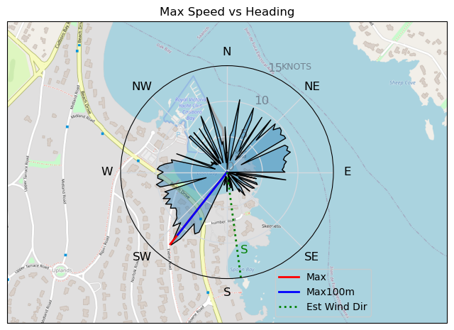
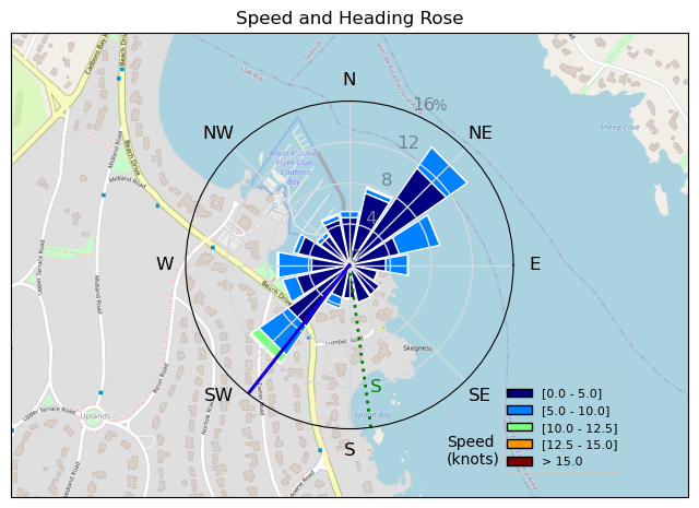
Speed (3s average)
| Speed | knots | km/h |
|---|---|---|
| Avg overall | 3.2 | 6.0 |
| Avg in motion | 6.2 | 11.5 |
| Max | 12.9 | 23.9 |
| Max 100m | 11.7 | 21.7 |
| Max 250m | 10.6 | 19.7 |
| Max 500m | 9.5 | 17.7 |
| Max 2s | 12.9 | 23.9 |
| Max 10s | 12.0 | 22.3 |
| Max Alpha (500/50m) | 8.9 | 16.5 |
| Avg Foiling | 8.5 | 15.8 |
Times and Duration
| Start | Thu Mar 28, 1:13 PM |
| End | Thu Mar 28, 1:43 PM |
| Duration | 00:29:55 |
| In motion | 00:15:32 |
| Paused (< 3 km/h) | 00:14:15 |
| Foiling | 00:07:30 |
| Not Foiling (< 8 km/h) | 00:22:17 |
| Longest Foiling Segment | 00:03:15 (843 m) |
| Last Calculated | Thu Mar 28, 8:28 PM |
Track Information
| Distance | 3.0 km |
| # Trackpoints | 642 |
| Avg Trackpoint distance | 4.6 m |
| Number of Turns | 18 |
| Foiling Turns (> 8 km/h) | 3 |
| Foiling Turn Percentage | 17% |


Category: Wingfoiling
10 months ago

Created 10 months ago
Highrocker |
Please register/login to download this track.
This track was downloaded 0 time(s). |
| 13 BWD got me addicted |
| 65 Falck’n Foot Switches |
| 64 250112 Cattle Point |
| 64 Speedy (for me) wave riding |
| 59 CP - TunaCan Flyby |
Please wait while loading suggestions..
Please wait while loading suggestions..
You must login to post comments.