Daves Demo Day
TunaCan - Wingfoiling |
Sunday April 14, 2024 4:37 PM |
| Spot | Ross Bay |
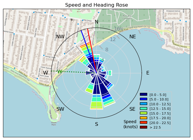
| Conditions | WSW 20-30, 2-3 |
| TOW | 2.0 hours |
| Details | Fun times, was watching it ramp up from home. Ran into BWD who leant me a MA1000 and HA190 to try out. 1000 I love, but cant figure out the tails, it was just so nose heavy, started with the 1 degree shim, didnt like that, went to no shim, still didnt feel right. So third time back to the beach and switched back to the 230 flow. I think the Takuma board might not work with the smaller Armstrong tails - not sure. Anywho - great session once gear sorted. Some of the juciest and well shaped swell i have seen there in awhile. Lots of stoke on the water! GPS paused at 9km in and didnt notice till the very end. Oh well... [from Session Log on Sunday April 14, 2024] |
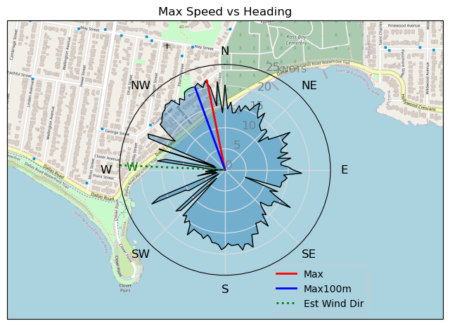
Speed (3s average)
| Speed | knots | km/h |
|---|---|---|
| Avg overall | 3.1 | 5.7 |
| Avg in motion | 9.2 | 17.1 |
| Max | 21.7 | 40.1 |
| Max 100m | 20.7 | 38.3 |
| Max 250m | 19.7 | 36.5 |
| Max 500m | 16.6 | 30.8 |
| Max 2s | 21.6 | 40.0 |
| Max 10s | 20.7 | 38.3 |
| Max Alpha (500/50m) | 15.9 | 29.5 |
| Avg Foiling | 12.7 | 23.6 |
Times and Duration
| Start | Sun Apr 14, 4:37 PM |
| End | Sun Apr 14, 7:00 PM |
| Duration | 02:23:02 |
| In motion | 00:48:04 |
| Paused (< 3 km/h) | 01:31:57 |
| Foiling | 00:26:43 |
| Not Foiling (< 8 km/h) | 01:53:18 |
| Longest Foiling Segment | 00:05:23 (2.2 km) |
| Last Calculated | Sun Apr 14, 9:06 PM |
Track Information
| Distance | 13.7 km |
| # Trackpoints | 4448 |
| Avg Trackpoint distance | 3.1 m |
| Number of Turns | 98 |
| Foiling Turns (> 8 km/h) | 19 |
| Foiling Turn Percentage | 19% |


Category: Wingfoiling
10 months ago

Created 10 months ago
TunaCan |
Please register/login to download this track.
This track was downloaded 0 time(s). |
| 18 BWD got me addicted |
| 65 Falck’n Foot Switches |
| 64 250112 Cattle Point |
| 64 Speedy (for me) wave riding |
| 59 CP - TunaCan Flyby |
Please wait while loading suggestions..
Please wait while loading suggestions..
You must login to post comments.