Singing Sands 06/17
mayday - Wingfoiling |
Monday June 17, 2024 8:42 AM |
| Spot | [Secret spot] |
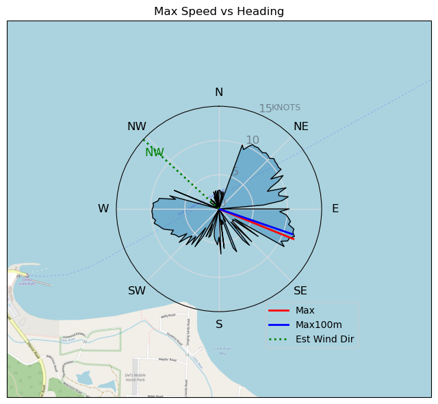
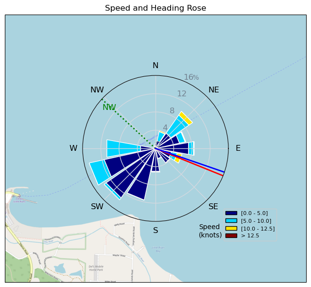
| Conditions | NW 10-12, chop, swell |
| TOW | 1.0 hours |
| Toys | 1880 reedin flight attendant |
| 5m duotone slick sls | |
| 115 quattro drifter | |
| Details | Well, THAT was interesting! Moderate NW, so not able to do home beach, so decided to try a new ( to me) spot - Singing Sands. Actually nice spot, with a slightly cross swell launch area - the main problem, as i happened to discover, is the ferry actually has to do a dogleg right near the beach- and i realized this just i dropped off the foil when the wind died:-( and saw said ferry approaching- luckily though, with a bit of vigorous pumping, was well clear by the time it arrived. Won't be making that mistake again! [from Session Log on Monday June 17, 2024] |
Speed (3s average)
| Speed | knots | km/h |
|---|---|---|
| Avg overall | 3.5 | 6.4 |
| Avg in motion | 5.3 | 9.7 |
| Max | 11.7 | 21.7 |
| Max 100m | 10.7 | 19.8 |
| Max 250m | 10.4 | 19.2 |
| Max 500m | 8.6 | 16.0 |
| Max 2s | 11.7 | 21.6 |
| Max 10s | 11.2 | 20.7 |
| Max Alpha (500/50m) | 4.1 | 7.6 |
| Avg Foiling | 8.4 | 15.5 |
Times and Duration
| Start | Mon Jun 17, 8:42 AM |
| End | Mon Jun 17, 9:44 AM |
| Duration | 01:01:58 |
| In motion | 00:40:50 |
| Paused (< 3 km/h) | 00:19:27 |
| Foiling | 00:16:05 |
| Not Foiling (< 8 km/h) | 00:44:12 |
| Longest Foiling Segment | 00:06:18 (1.6 km) |
| Last Calculated | Mon Jun 24, 7:24 PM |
Track Information
| Distance | 6.6 km |
| # Trackpoints | 3717 |
| Avg Trackpoint distance | 1.8 m |
| Number of Turns | 8 |
| Foiling Turns (> 8 km/h) | 2 |
| Foiling Turn Percentage | 25% |


Category: Wingfoiling
6 months ago

Created 6 months ago
mayday |
Please register/login to download this track.
This track was downloaded 0 time(s). |
| 38 241124 Willows |
| 42 WillowsQuickie |
| 38 Willows - Sunday Funday Woops |
| 41 Willows Mixed Bag |
| 30 Surprise Sunday ENE. |
Please wait while loading suggestions..
Please wait while loading suggestions..
You must login to post comments.