June 28 Lake Nitinaht
JCH - Kitesurfing |
Friday June 28, 2024 4:50 PM |
| Spot | Nitinat Lk |
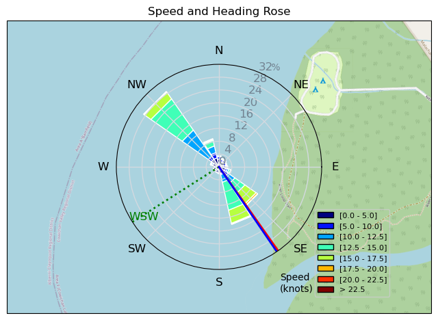
| Conditions | W 17-19, Mostly overcast |
| TOW | 9.9 hours |
| Toys | 12 Duotone NEO SLS |
| 150 Ocean rodeo Mako | |
| Details | Used the Elevation Kite and Wing Center NEO SLS 12m. The wind was a bit strong for the 13m, and I was concerned that the wind would die and my 10m would not be big enough to get me home. Good session, the 12m was a good pick. I think I would have been OK with the 10m. Used the twin tip to get my confidence back, did lots of toe side riding. Getting better at it, able to doe some nice carving jibs. [from Session Log on Friday June 28, 2024] |
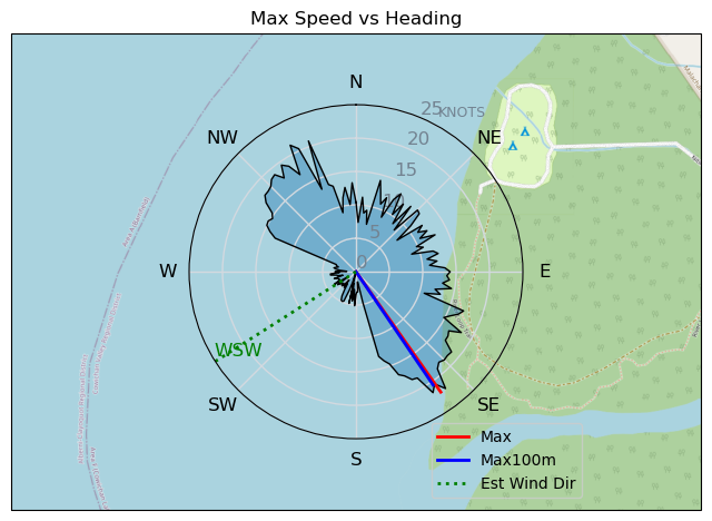
Speed (3s average)
| Speed | knots | km/h |
|---|---|---|
| Avg overall | 9.3 | 17.3 |
| Avg in motion | 11.6 | 21.5 |
| Max | 22.0 | 40.8 |
| Max 100m | 20.0 | 37.1 |
| Max 250m | 17.9 | 33.2 |
| Max 500m | 16.4 | 30.4 |
| Max 2s | 21.8 | 40.3 |
| Max 10s | 20.0 | 37.1 |
| Max Alpha (500/50m) | 15.2 | 28.1 |
| Avg Planing | 12.7 | 23.6 |
Times and Duration
| Start | Fri Jun 28, 4:50 PM |
| End | Fri Jun 28, 5:47 PM |
| Duration | 00:57:07 |
| In motion | 00:45:56 |
| Paused (< 3 km/h) | 00:09:09 |
| Planing | 00:39:57 |
| Not Planing (< 8 km/h) | 00:15:08 |
| Longest Planing Segment | 00:25:14 (9.9 km) |
| Last Calculated | Fri Jun 28, 9:41 PM |
Track Information
| Distance | 16.5 km |
| # Trackpoints | 3425 |
| Avg Trackpoint distance | 4.8 m |
| Number of Turns | 69 |
| Planing Turns (> 8 km/h) | 38 |
| Planing Turn Percentage | 55% |


Category: Kitesurfing
5 months ago
Created 5 months ago
JCH |
Please register/login to download this track.
This track was downloaded 0 time(s). |
| 37 241124 Willows |
| 40 WillowsQuickie |
| 37 Willows - Sunday Funday Woops |
| 37 Willows Mixed Bag |
| 28 Surprise Sunday ENE. |
Please wait while loading suggestions..
Please wait while loading suggestions..
You must login to post comments.