Better late than never
slake - Wingfoiling |
Monday September 02, 2024 1:37 PM |
| Spot | Nitinat Lk |
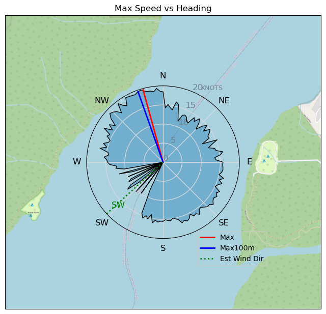
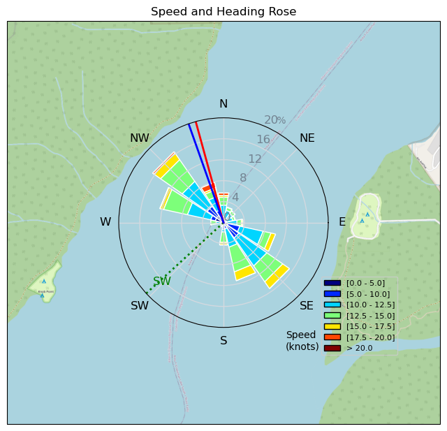
| Conditions | SW 10-20, flat to 1' |
| TOW | 1.5 hours |
| Toys | 5'8" 110L Fanatic Sky Wing |
| 5'5" 88L Armstrong Wing SUP | |
| 6.1m Armstrong XPS | |
| Armstrong HS1850 | |
| Armstrong HA925 | |
| Details | Better late than never. Final day of '24 at Nitnat. S.O. gybing and riding switch. Fun to see her do this. Seemed like an international UBC? crew was out to windsurf Labour Day but it was light for sometime, and overcast. Got out at first ripples with the 110L board/HS1850. Then the S.O. took that board and I went on the 88L. Quick session to feed the need. Then return to reality. Nice to meet some new faces and hear interesting stories...like someone (can't use real names here!) telling Tempy he was there "on purpose" after going out when the wind had died. The whole "on purpose" thing then got milked to no end. Also fun to hear the origin of the name Tempy...wow some folks have been going to Nitinat for a looooong time!! [from Session Log on Monday September 02, 2024] |
Speed (3s average)
| Speed | knots | km/h |
|---|---|---|
| Avg overall | 9.1 | 16.9 |
| Avg in motion | 11.9 | 22.0 |
| Max | 19.7 | 36.5 |
| Max 100m | 19.4 | 35.9 |
| Max 250m | 19.0 | 35.2 |
| Max 500m | 18.3 | 34.0 |
| Max 2s | 19.6 | 36.3 |
| Max 10s | 19.4 | 35.9 |
| Max Alpha (500/50m) | 14.1 | 26.1 |
| Avg Foiling | 12.4 | 23.1 |
Times and Duration
| Start | Mon Sep 02, 1:37 PM |
| End | Mon Sep 02, 3:35 PM |
| Duration | 01:57:26 |
| In motion | 01:30:31 |
| Paused (< 3 km/h) | 00:26:39 |
| Foiling | 01:24:25 |
| Not Foiling (< 8 km/h) | 00:32:45 |
| Longest Foiling Segment | 00:27:00 (9.8 km) |
| Last Calculated | Sun Sep 08, 4:12 PM |
Track Information
| Distance | 33.2 km |
| # Trackpoints | 2899 |
| Avg Trackpoint distance | 11.4 m |
| Number of Turns | 90 |
| Foiling Turns (> 8 km/h) | 75 |
| Foiling Turn Percentage | 83% |


Category: Wingfoiling
3 months ago

Created 3 months ago
slake |
Please register/login to download this track.
This track was downloaded 0 time(s). |
| 32 241124 Willows |
| 34 WillowsQuickie |
| 32 Willows - Sunday Funday Woops |
| 30 Willows Mixed Bag |
| 25 Surprise Sunday ENE. |
Please wait while loading suggestions..
Please wait while loading suggestions..
You must login to post comments.