Columbia Delivers
tweezer - Wingfoiling |
Thursday September 26, 2024 2:00 PM |
| Spot | Columbia Bch |
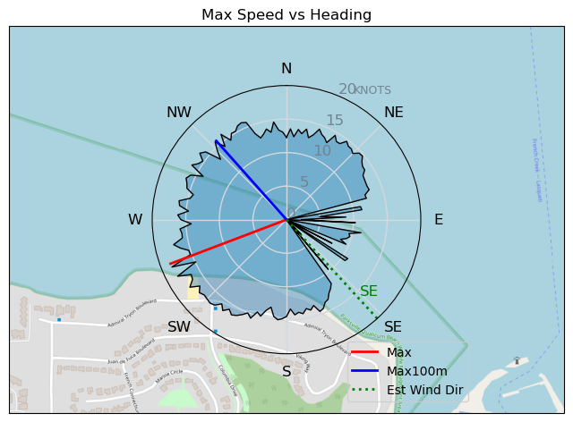
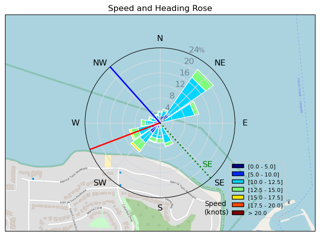
| Conditions | SE 15-25, 1-4ft |
| TOW | 2.0 hours |
| Toys | Axis ART 899 |
| 93 Nolimitz V3 | |
| 360/45 Axis 360/45 skinny | |
| 56cm Axis Sillyshort Advance fuse | |
| 4.0 Cabrinha Mantis | |
| 4ft9 65l Appletree Custom | |
| Details | Columbia came through! I arrived around 11:30 to barely 10 knots on the beach. Whitecaps were visible on the outside. Smartang was out first on a 5m wing looking good. It kicked up a notch or 2 and everyone was on it. Half a dozen each of windsurfers and wings and Sean who made the day trip from the north shore was the solo kiter. Waves were good to start and then got a little mushy, then they kicked back in. Wind also sagged for a bit but held for the foils. Fun laps! Looked like the best was after I came in. [from Session Log on Thursday September 26, 2024] |
Speed (3s average)
| Speed | knots | km/h |
|---|---|---|
| Avg overall | 9.3 | 17.2 |
| Avg in motion | 10.6 | 19.5 |
| Max | 18.5 | 34.2 |
| Max 100m | 15.3 | 28.4 |
| Max 250m | 13.5 | 25.1 |
| Max 500m | 12.8 | 23.8 |
| Max 2s | 18.4 | 34.0 |
| Max 10s | 15.7 | 29.1 |
| Max Alpha (500/50m) | 12.8 | 23.6 |
| Avg Foiling | 11.1 | 20.5 |
Times and Duration
| Start | Thu Sep 26, 2:00 PM |
| End | Thu Sep 26, 4:13 PM |
| Duration | 02:13:32 |
| In motion | 01:57:42 |
| Paused (< 3 km/h) | 00:15:48 |
| Foiling | 01:49:14 |
| Not Foiling (< 8 km/h) | 00:24:16 |
| Longest Foiling Segment | 00:11:23 (4.0 km) |
| Last Calculated | Thu Sep 26, 11:02 PM |
Track Information
| Distance | 38.3 km |
| # Trackpoints | 6861 |
| Avg Trackpoint distance | 5.6 m |
| Number of Turns | 145 |
| Foiling Turns (> 8 km/h) | 126 |
| Foiling Turn Percentage | 87% |


Category: Wingfoiling
one month ago

Created one month ago
tweezer |
Please register/login to download this track.
This track was downloaded 0 time(s). |
| 31 241124 Willows |
| 34 WillowsQuickie |
| 31 Willows - Sunday Funday Woops |
| 29 Willows Mixed Bag |
| 24 Surprise Sunday ENE. |
Please wait while loading suggestions..
Please wait while loading suggestions..
You must login to post comments.