NN - Day 5
Bobson - Windfoiling |
Tuesday May 23, 2023 11:15 AM |
| Spot | Nitinat Lk |
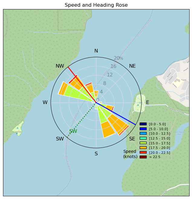
| Conditions | W 18-22, Not too wavy |
| TOW | 3.5 hours |
| Toys | 1100 Starboard Front wing |
| 255 Starboard Stabilizer | |
| 85cm Starboard Mast | |
| 115+ Starboard Fuse | |
| 5.2 Sailworks Flyer | |
| 7.0 Sailworks Flyer | |
| 150 Starboard Freeride | |
| Details | Started at 11 and sailed through till 5pm. So steady today. Basically 20 kts all day. 115kms today and only 1 other kite on the water. Sunny and waters getting warmer. 3/2 sleeveless suit. This is day 5 and I'm running out of food and bike but hopefully KC7-Renegade is coming with a resupply truck. When I got off the water at 5pm it was still blowing 20kts but I am just too tired to do any more. Corona in hand already! Forecast for next few days looks great! 3 other people in the campground now. Pretty quiet. BOBSON OUT!! [from Sailing Log on Tuesday May 23, 2023] |
Speed (3s average)
| Speed | knots | km/h |
|---|---|---|
| Avg overall | 10.5 | 19.5 |
| Avg in motion | 17.0 | 31.4 |
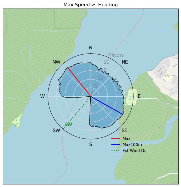
| Max | 21.6 | 40.0 |
| Max 100m | 21.3 | 39.4 |
| Max 250m | 21.0 | 38.9 |
| Max 500m | 20.8 | 38.6 |
| Max 2s | 21.6 | 40.0 |
| Max 10s | 21.3 | 39.4 |
| Max Alpha (500/50m) | 18.5 | 34.3 |
| Avg Foiling | 17.0 | 31.5 |
Times and Duration
| Start | Tue May 23, 11:15 AM |
| End | Tue May 23, 5:15 PM |
| Duration | 05:59:56 |
| In motion | 03:42:50 |
| Paused (< 3 km/h) | 02:15:27 |
| Foiling | 03:41:55 |
| Not Foiling (< 8 km/h) | 02:16:22 |
| Last Calculated | Sat May 27, 6:02 PM |
Track Information
| Distance | 116.7 km |
| # Trackpoints | 13518 |
| Avg Trackpoint distance | 8.6 m |
| Number of Turns | 174 |
| Foiling Turns (> 8 km/h) | 170 |
| Foiling Turn Percentage | 98% |


Category: Windfoiling
one year ago

Created one year ago
Bobson |
Please register/login to download this track.
This track was downloaded 0 time(s). |
| 35 241120 Willows |
| 42 Willows Bomb Session |
| 42 Shoot the Entrance |
| 34 CloverPartDeux |
| 25 Come back soon Bombo |
Please wait while loading suggestions..
Please wait while loading suggestions..
You must login to post comments.