20241018
ThePope - Wingfoiling |
Friday October 18, 2024 3:05 PM |
| Spot | Willows Bch |
| Conditions | SE 20-30, 1m |
| TOW | 2.0 hours |
| Toys | 99L Armstrong FG Wing SUP |
| 5.5m Duotone Unit | |
| 4m Duotone Unit | |
| 1475 Armstrong MA | |
| 1225 Armstrong MA | |
| 70 Armstrong Fuse | |
| 865 Armstrong Mast | |
| 235 Armstrong Flow | |
| Popemobile | |
| Details | Launched just as the wind started drop, so I came in and waited it out with all the regular crew. While we waited many of the early shifters packed it up for the day, and at one point we were treated to the sight of Bobson's bare ass, which I assume must be a rite of passage in this community. A wind line appeared so I relaunched and had two hours in some of the gnarliest winds I've experienced. Super gusty, shifty AF, huge holes -- constant adjustments were required to stay upright. It was a workout. Nice to get out though. [from Session Log on Friday October 18, 2024] |
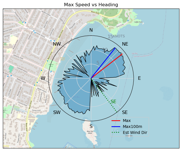
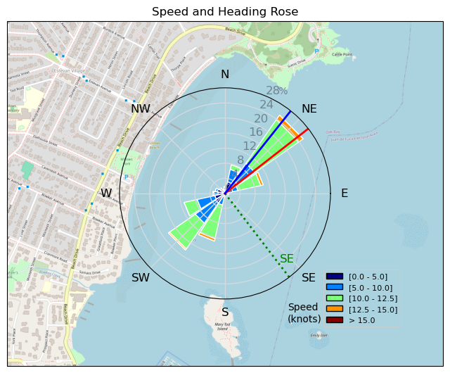
Speed (3s average)
| Speed | knots | km/h |
|---|---|---|
| Avg overall | 5.7 | 10.6 |
| Avg in motion | 8.0 | 14.9 |
| Max | 13.9 | 25.7 |
| Max 100m | 13.4 | 24.9 |
| Max 250m | 12.9 | 23.9 |
| Max 500m | 12.5 | 23.1 |
| Max 2s | 13.8 | 25.5 |
| Max 10s | 13.5 | 25.1 |
| Max Alpha (500/50m) | 10.5 | 19.4 |
| Avg Foiling | 9.7 | 18.0 |
Times and Duration
| Start | Fri Oct 18, 3:05 PM |
| End | Fri Oct 18, 5:00 PM |
| Duration | 01:55:09 |
| In motion | 01:21:52 |
| Paused (< 3 km/h) | 00:33:13 |
| Foiling | 00:58:49 |
| Not Foiling (< 8 km/h) | 00:56:16 |
| Longest Foiling Segment | 00:03:08 (1.1 km) |
| Last Calculated | Fri Oct 18, 9:07 PM |
Track Information
| Distance | 20.3 km |
| # Trackpoints | 4367 |
| Avg Trackpoint distance | 4.7 m |
| Number of Turns | 19 |
| Foiling Turns (> 8 km/h) | 3 |
| Foiling Turn Percentage | 16% |


Category: Wingfoiling
5 weeks ago

Created 5 weeks ago
ThePope |
Please register/login to download this track.
This track was downloaded 0 time(s). |
| 28 241120 Willows |
| 36 Willows Bomb Session |
| 37 Shoot the Entrance |
| 27 CloverPartDeux |
| 20 Come back soon Bombo |
Please wait while loading suggestions..
Please wait while loading suggestions..
You must login to post comments.