DOG - Cattle Poiint - Oct 25/24
rsmundell - Wingfoiling |
Friday October 25, 2024 5:03 PM |
| Spot | Cattle Pt |
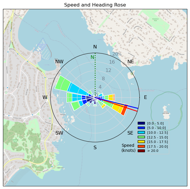
| Conditions | N 8-18, Chop |
| TOW | 0.8 hours |
| Toys | 110 KT Dragonfly DW Board 7'7" |
| 7.0 Ocean Rodeo A Series Glide V4 | |
| 900 AFS Enduro | |
| 43 AFS HA43 | |
| 80 AFS UHM 80 Fuselink mast | |
| Details | Quick evening session after watching the wind all afternoon. Arrived to what would have been fine 5m wind in puffs but didn't want to get stuck if it dropped before dark so pumped the 7m. Definitely powered up so I stuck to upwinds and DWs. Went up to the YC and did a few speed runs in the flat water before working my way back down to the mouth of the bay. Would to do that again but with the 700! I need to learn the way to gybe when your overtaking the wing. The Heinekin? By the time I went in it was gusting 18 and a real struggle to do anything but UW/DW. Fun flat water northerly session. [from Session Log on Friday October 25, 2024] |
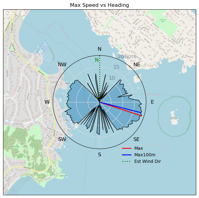
Speed (3s average)
| Speed | knots | km/h |
|---|---|---|
| Avg overall | 8.8 | 16.4 |
| Avg in motion | 11.1 | 20.5 |
| Max | 19.0 | 35.2 |
| Max 100m | 18.6 | 34.5 |
| Max 250m | 18.2 | 33.8 |
| Max 500m | 17.2 | 31.9 |
| Max 2s | 19.0 | 35.2 |
| Max 10s | 18.6 | 34.5 |
| Max Alpha (500/50m) | 11.6 | 21.4 |
| Avg Foiling | 12.5 | 23.2 |
Times and Duration
| Start | Fri Oct 25, 5:03 PM |
| End | Fri Oct 25, 5:54 PM |
| Duration | 00:51:13 |
| In motion | 00:40:54 |
| Paused (< 3 km/h) | 00:09:09 |
| Foiling | 00:33:54 |
| Not Foiling (< 8 km/h) | 00:16:09 |
| Longest Foiling Segment | 00:05:21 (2.4 km) |
| Last Calculated | Fri Oct 25, 10:11 PM |
Track Information
| Distance | 14.0 km |
| # Trackpoints | 1299 |
| Avg Trackpoint distance | 10.8 m |
| Number of Turns | 14 |
| Foiling Turns (> 8 km/h) | 9 |
| Foiling Turn Percentage | 64% |


Category: Wingfoiling
4 weeks ago

Created 4 weeks ago
rsmundell |
Please register/login to download this track.
This track was downloaded 0 time(s). |
| 24 241120 Willows |
| 32 Willows Bomb Session |
| 34 Shoot the Entrance |
| 26 CloverPartDeux |
| 17 Come back soon Bombo |
Please wait while loading suggestions..
Please wait while loading suggestions..
You must login to post comments.